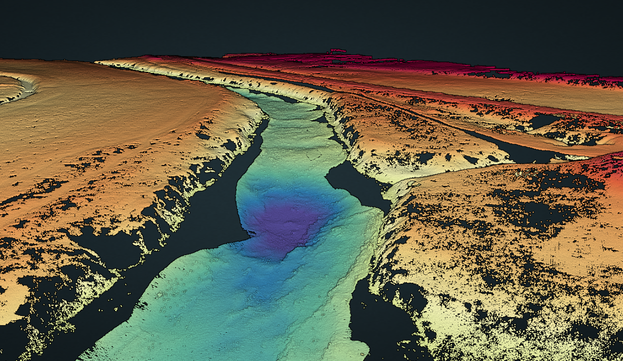
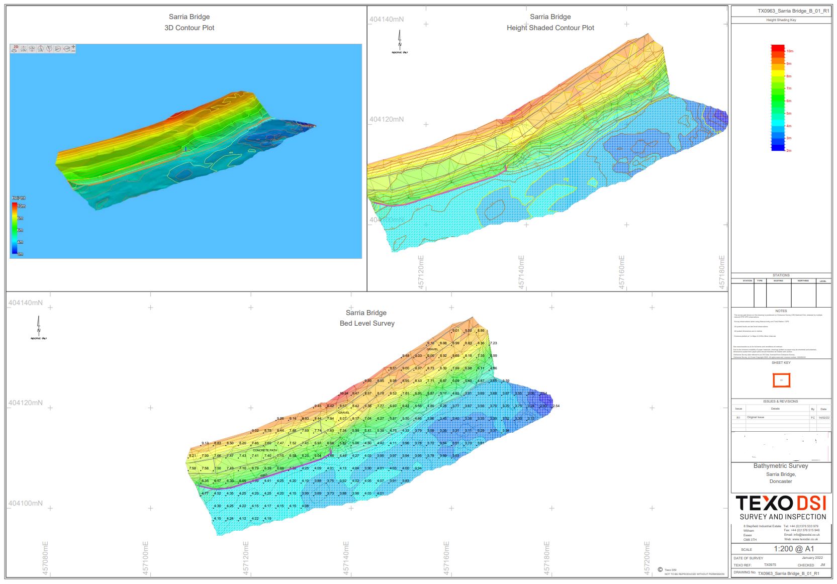
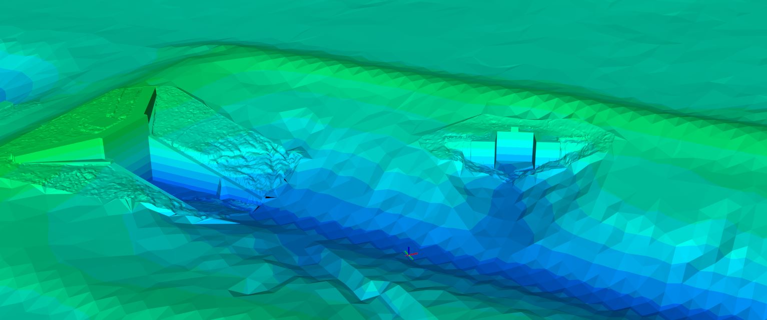
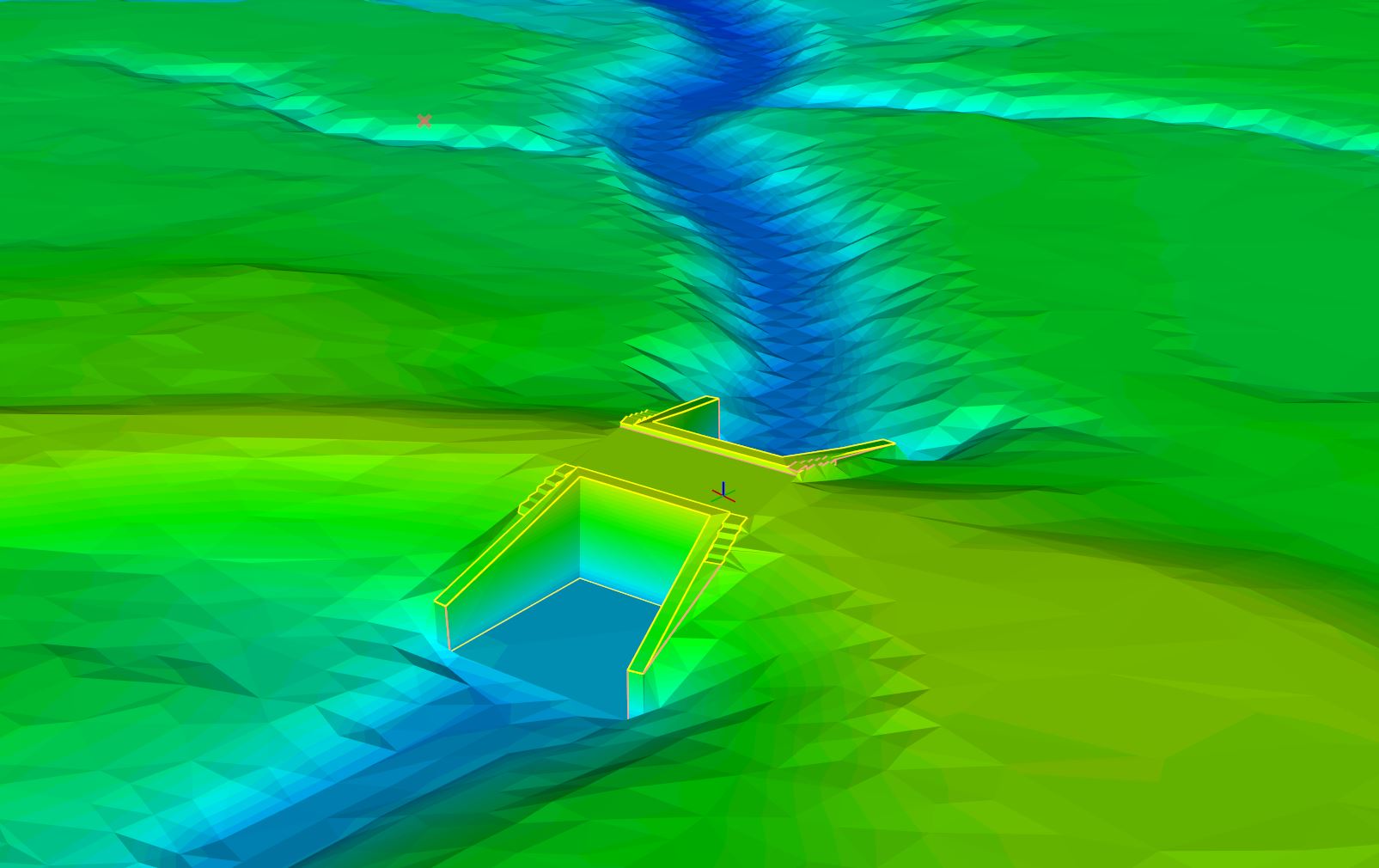
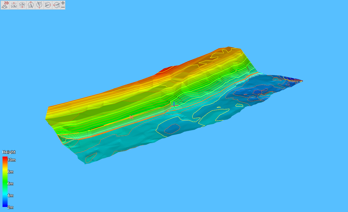
Our Hydrographic Surveys or Bathymetric Surveys services provide an accurate, highly detailed below water level plan of the terrain. Using state of the art equipment Texo to accurately map the profile of rivers, lakes, harbours, and reservoirs which help to inform flood assessments and future construction projects.
Utilising our bathymetric services in conjunction with our mobile mapping and UAS LIDAR services offers a truly unique above and below ground solution that offers un-paralleled data resolution and accuracy.
With a fleet of sensors and platforms in house TEXO are able to tailor the survey methodology to the specific needs.
Single Beam Bathymetry
- The use of our versatile single beam sensors allow rapid and easy deployment
- A cost-effective solution tailored for use on our automated survey boats or manned platforms
- Down to meter level resolution on the surface, suitable for digital terrain model generation
- Ideal for small rivers, lakes, reservoirs and bodies of water
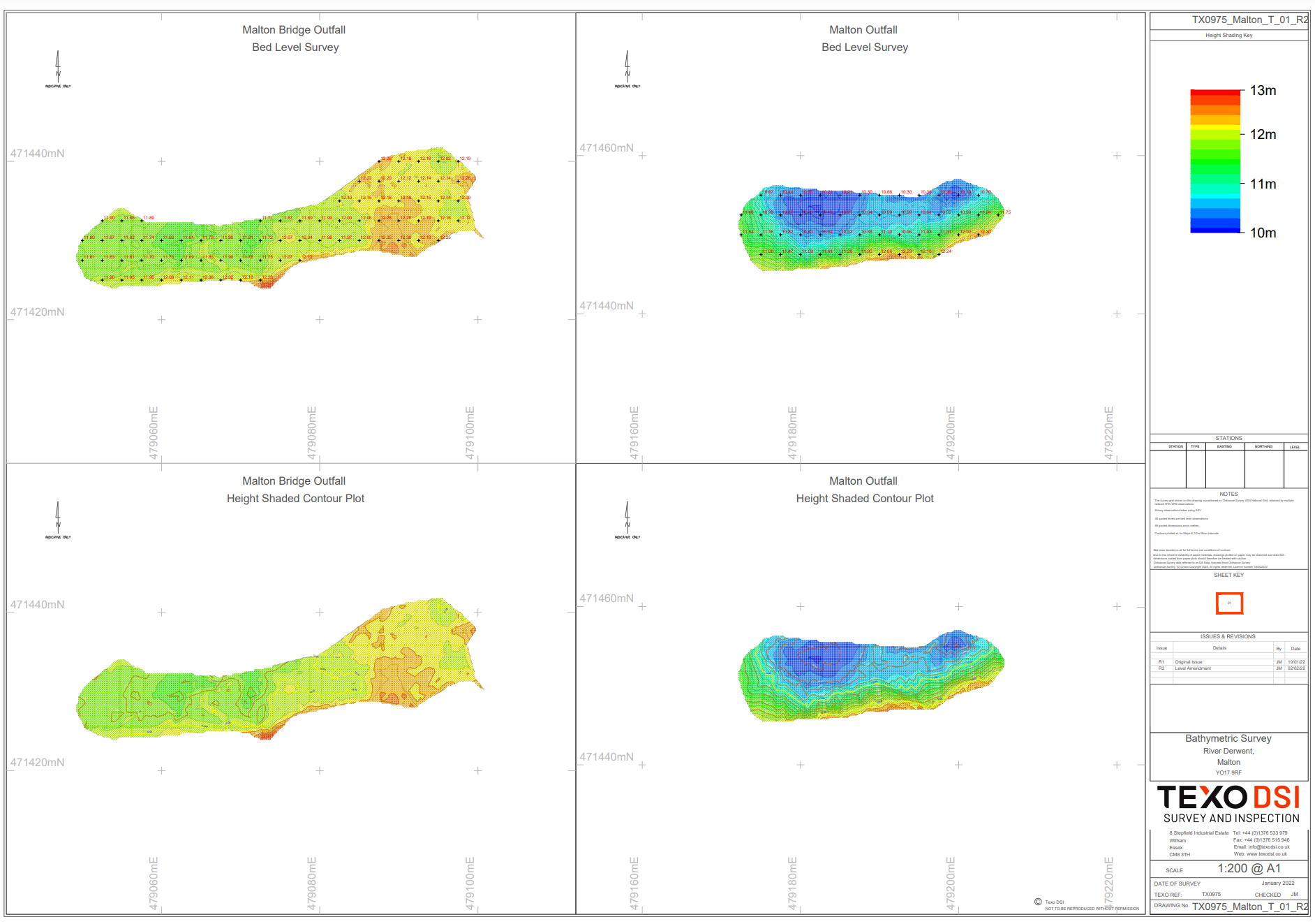
Multibeam Bathymetry
- Offering high resolution bed level coverage on larger areas
- Highly detailed surface outputs for digital terrain mapping that allowed enhanced bed observation
- Suitable for all types of projects including large mapping runs
Unmanned Survey Vessel
- Using our USV technology improves project safety performance by mitigating the need to put personnel on the water
- Used in areas where manned vessels are not suitable
- Single beam and multibeam sensors can be mounted to the ASV
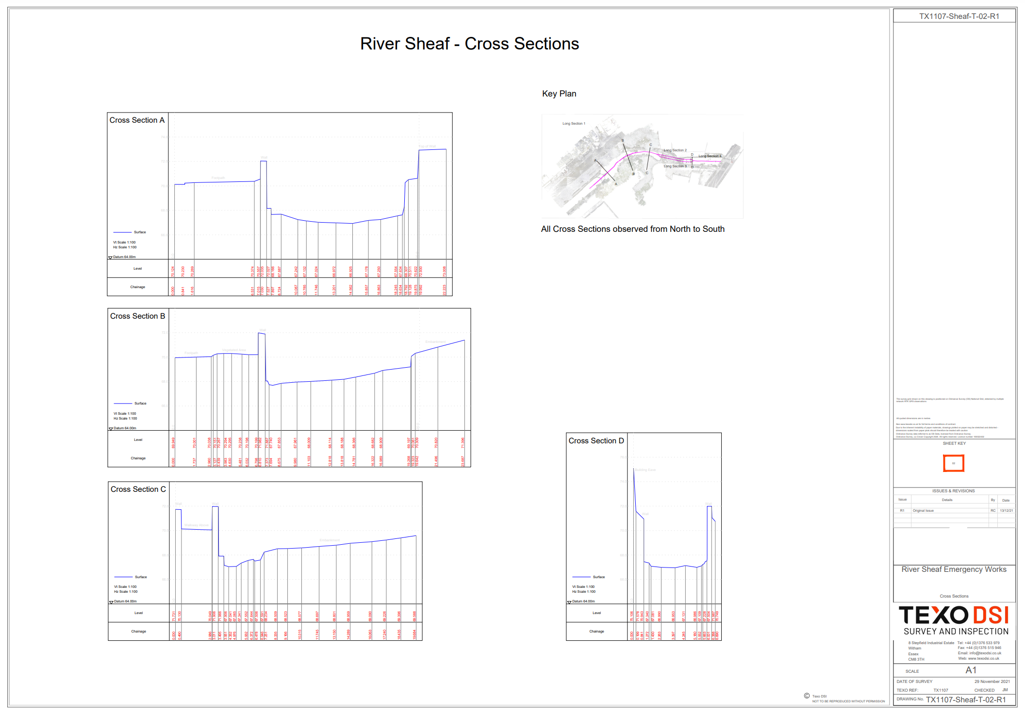
Manned entry
- When needed our surveyors are able to entry the watercourse and collect bed levels using total station and GPS technology
- River Cross sections, silt level observations and many more all can be conducted using this metholdogy where it is safe to do so