Our client is a large house-building firm who had bought a large development site in the south east of around 38 hectares. We have worked with the company on a number of occasions across a range of sites and they trust us to deliver accurate work to a tight timescale.
The company had commissioned topographical survey work previously, but the suppliers had been unable to provide detailed enough data, because much of the site is forested. There was also an old quarry and a munitions dump on the site, which made on-the-ground surveying hazardous. They needed a different way to map the site, so that they could move forward with development plans as safely as possible and to keep the project within cost estimates.

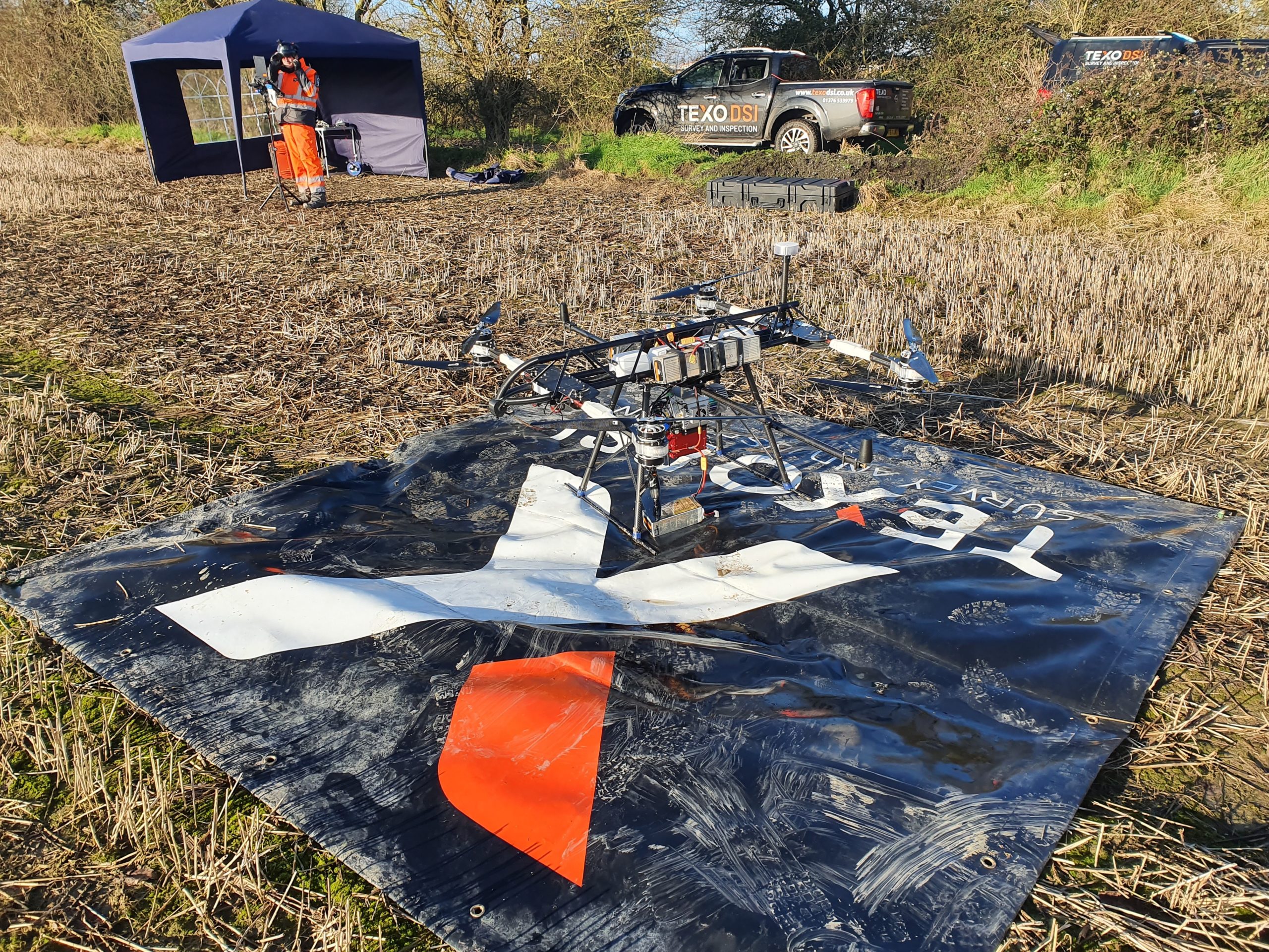
Initially, we were asked to survey defined sections of the site, in order to see what results we could deliver. We used our airborne LIDAR survey scanner to collect data from the defined area. Our scanner covers around one million points per second and has multiple returns, which allows it to differentiate between vegetation and hard ground – ideal for a quarry survey.
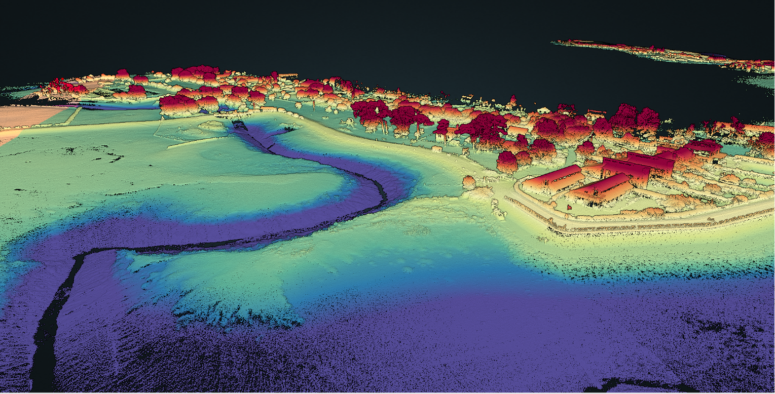
Once the scans were complete, we were able to produce ‘classifier’ point cloud results. These allow us to produce separate point clouds for elements like areas of low and high vegetation, and we can also strip all vegetation away from the scan, leaving just the bare ground topography. From this, we can pick out water and river systems, revealing previously unknown features to help define accurate cut and fill survey costs to the client, even before the site has been purchased. This is a perfect example of the way a UAS survey approach can generate more accurate and useful data than traditional methods.
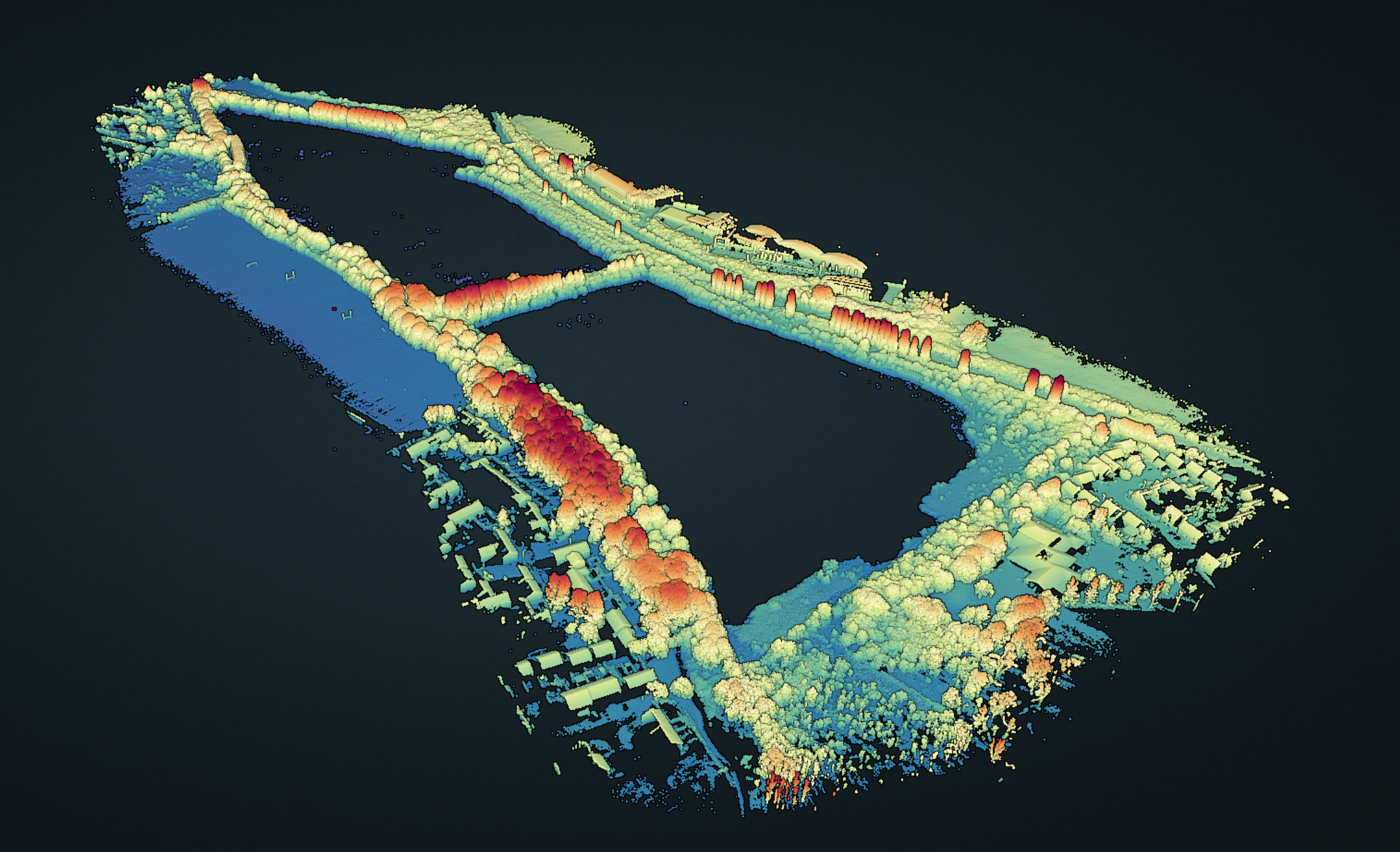
We delivered CAD drawings of previously un-surveyable areas, that showed contours, ground heights and other topological features. This is the first time that an airborne LIDAR scanner, accurate to 5mm (relative) and 10mm (absolute), has been used to deliver topographically accurate line drawings that can remove overlying features to reveal the ground with accuracy.